
Alphabau Engineering
Engineering Office for Planning . Building . Consulting


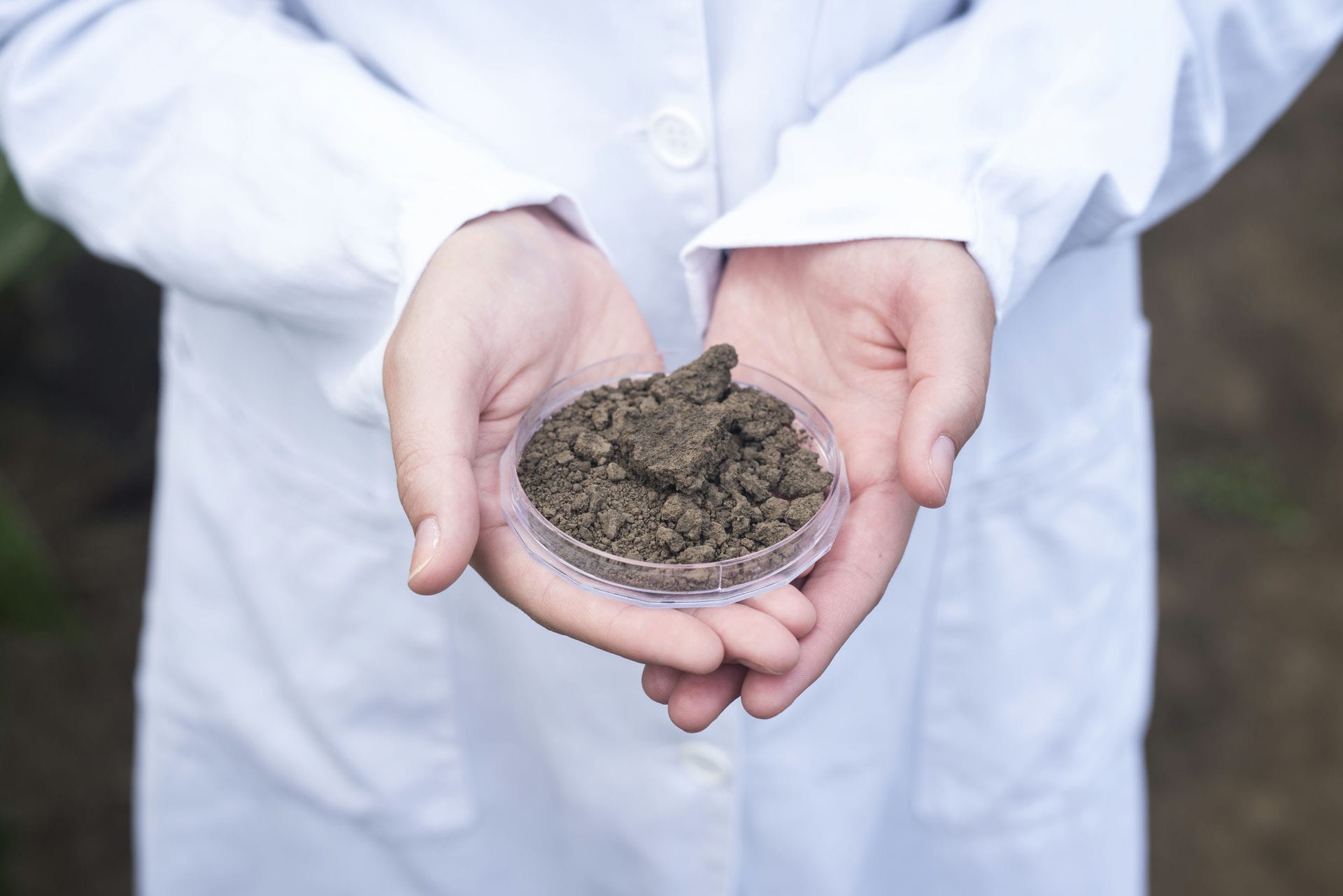
What is a Geotechnical Survey?
A geotechnical survey involves a geological investigation that describes the soil properties at a specific construction site. It provides information on soil load-bearing capacity, soil types, groundwater conditions, and potential risks such as settlement or landslides. The survey is a crucial basis for planning foundations, substructures, and other construction measures. It evaluates how the soil interacts with the planned structures and identifies any special requirements for construction execution.
Erfahren Sie mehr: Structural Engineering
Unsere Leistungen im Überblick – gemeinsam mit unseren Expertenpartnern
- Dynamic probing
- Borehole investigations
- Deep and rock core drilling
- Pressure probing
- CPT- Test
- Water law applications for excavation work
Erfahren Sie mehr: Statiker
- Determination of soil mechanical and physical properties for classification and load-bearing assessments
- Investigation of soil compaction and load-bearing capacity according to DIN 18127 and DIN 18134
- Rock mechanics analyses to determine rock strength and weathering resistance
- Load-bearing capacity forecasts and stability analyses for soil-binder mixtures
- Material analysis for base layers and recycled materials according to RStO and TL SoB-StB
- Assessment of concrete aggressiveness and soil corrosivity according to DIN 4030
- Groundwater monitoring, including short- and long-term water level forecasts
- Site and field investigations
- Recommendations for foundation types, including bearing capacity calculations and potential deep foundation requirements
- Erfahren Sie mehr: Statiker Kosten 2025: Was kostet ein Statiker wirklich?
Hinweis: „Alle Angaben in diesem Beitrag wurden mit größtmöglicher Sorgfalt erstellt und dienen ausschließlich allgemeinen Informationszwecken. Änderungen bei gesetzlichen Vorgaben, regionalen Vorschriften oder Förderprogrammen sind jederzeit möglich. Eine Gewähr für die Aktualität, Vollständigkeit oder Richtigkeit der Inhalte können wir daher nicht übernehmen.
Für verbindliche Auskünfte wenden Sie sich bitte an die zuständigen Behörden oder Fachstellen. Sollten Fehler oder Abweichungen festgestellt werden, übernehmen wir keine Haftung. Wir freuen uns jedoch über entsprechende Hinweise.
Find us – simply select your federal state
Start your construction project today!
Select your federal state on the map to start your construction project!
Schleswig-Holstein
Kiel
Lübeck
Flensburg
Neumünster
Ahrensburg
Arnis
Bad Bramstedt
Bad Oldesloe
Bad Schwartau
Bad Segeberg
Bargteheide
Barmstedt
Bredstedt
Brunsbüttel
Büdelsdorf
Eckernförde
Elmshorn
Eutin
Fehmarn
Friedrichstadt
Garding
Geesthacht
Glinde
Glücksburg (Ostsee)
Glückstadt
Heide
Heiligenhafen
Husum
Itzehoe
Kaltenkirchen
Kappeln
Kellinghusen
Krempe
Lauenburg/ Elbe
Lütjenburg
Marne
Meldorf
Mölln
Neustadt in Holstein
Niebüll
Norderstedt
Nortorf
Oldenburg in Holstein
Pinneberg
Plön
Preetz
Quickborn
Ratzeburg
Reinbek
Reinfeld (Holstein)
Rendsburg
Schenefeld
Schleswig
Schwarzenbek
Schwentinental
Tornesch
Tönning
Uetersen
Wahlstedt
Wedel
Wesselburen
Wilster
Wyk auf Föhr
Hamburg
Hamburg, Freie und Hansestadt
Niedersachsen
Achim
Alfeld (Leine)
Aurich
Bad Bentheim
Bad Bevensen
Bad Fallingbostel
Bad Gandersheim
Bad Harzburg
Bad Iburg
Bad Lauterberg im Harz
Bad Münder am Deister
Bad Nenndorf
Bad Pyrmont
Bad Sachsa
Bad Salzdetfurth
Barsinghausen
Bassum
Bergen
Bersenbrück
Bleckede
Bockenem
Bodenwerder, Münchhausenstadt
Borkum
Brake (Unterweser)
Bramsche
Braunlage
Bremervörde
Buchholz in der Nordheide
Burgdorf
Burgwedel
Buxtehude, Hansestadt
Bückeburg
Celle
Clausthal-Zellerfeld, Berg- und Universitätsstadt
Cloppenburg
Cuxhaven
Damme
Dannenberg (Elbe)
Dassel
Delmenhorst
Diepholz
Dinklage
Dissen am Teutoburger Wald
Dransfeld
Duderstadt
Einbeck
Elsfleth
Elze
Emden
Eschershausen
Esens
Freren
Friesoythe
Fürstenau
Garbsen
Geestland
Gehrden
Georgsmarienhütte
Gifhorn
Goslar
Gronau (Leine)
Göttingen
Hameln
Hann. Münden
Hannover
Braunschweig
Osnabrück
Oldenburg
Hardegsen
Haren (Ems)
Haselünne
Helmstedt
Hemmingen
Hemmoor
Herzberg am Harz
Hessisch Oldendorf
Hildesheim
Hitzacker (Elbe)
Holzminden
Hoya
Jever
Königslutter am Elm
Laatzen
Langelsheim
Langenhagen
Leer (Ostfriesland)
Lehrte
Lingen (Ems)
Lohne (Oldenburg)
Löningen
Lüchow (Wendland)
Lüneburg, Hansestadt
Melle
Meppen
Moringen
Munster
Neuenhaus
Neustadt am Rübenberge
Nienburg (Weser)
Norden
Nordenham
Norderney
Nordhorn
Northeim
Obernkirchen
Osterholz-Scharmbeck
Osterode am Harz
Otterndorf
Papenburg
Pattensen
Peine
Quakenbrück
Rehburg-Loccum
Rethem (Aller)
Rinteln
Rodenberg
Ronnenberg
Rotenburg (Wümme)
Sachsenhagen
Salzgitter
Sarstedt
Schnackenburg
Schneverdingen
Schortens
Schöningen
Schöppenstedt
Schüttorf
Seelze
Seesen
Sehnde
Soltau
Springe
Stade, Hansestadt
Stadthagen
Stadtoldendorf
Sulingen
Syke
Twistringen
Uelzen, Hansestadt
Uslar
Varel
Vechta
Verden (Aller)
Visselhövede
Walsrode
Weener
Werlte
Westerstede
Wiesmoor
Wildeshausen
Wilhelmshaven
Winsen (Luhe)
Wittingen
Wittmund
Wolfenbüttel
Wolfsburg
Wunstorf
Wustrow (Wendland)
Zeven
Bremen
Bremen
Bremerhaven
Nordrhein-Westfalen
Düsseldorf
Köln
Dortmund
Essen
Aachen
Ahaus
Ahlen
Alsdorf
Altena
Arnsberg
Attendorn, Hansestadt
Bad Berleburg
Bad Driburg
Bad Honnef
Bad Laasphe
Bad Lippspringe
Bad Münstereifel
Bad Oeynhausen
Bad Salzuflen
Bad Wünnenberg
Baesweiler
Balve
Barntrup
Beckum
Bedburg
Bergheim
Bergisch Gladbach
Bergkamen
Bergneustadt
Beverungen
Bielefeld
Billerbeck
Blomberg
Bocholt
Bochum
Bonn
Borgentreich, Orgelstadt
Borgholzhausen
Borken
Bornheim
Bottrop
Brakel
Breckerfeld, Hansestadt
Brilon
Brühl
Burscheid
Bünde
Büren
Castrop-Rauxel
Coesfeld
Datteln
Delbrück
Detmold
Dinslaken
Dormagen
Dorsten
Drensteinfurt
Drolshagen
Duisburg
Dülmen
Düren
Elsdorf
Emmerich am Rhein
Emsdetten
Enger, Widukindstadt
Ennepetal der Kluterthöhle
Ennigerloh
Erftstadt
Erkelenz
Erkrath, Fundort des Neanderthalers
Erwitte
Eschweiler
Espelkamp
Euskirchen
Frechen
Freudenberg
Fröndenberg/Ruhr
Geilenkirchen
Geldern
Gelsenkirchen
Gescher, Glockenstadt
Geseke
Gevelsberg
Gladbeck
Goch
Greven
Grevenbroich
Gronau (Westf.)
Gummersbach
Gütersloh
Haan
Hagen der FernUniversität
Halle (Westf.)
Hallenberg
Haltern am See
Halver
Hamm
Hamminkeln
Harsewinkel, Die Mähdrescherstadt
Hattingen
Heiligenhaus
Heimbach
Heinsberg
Hemer
Hennef (Sieg)
Herdecke
Herford, Hansestadt
Herne
Herten
Herzogenrath
Hilchenbach
Hilden
Horn-Bad Meinberg
Horstmar der Burgmannshöfe
Hörstel
Höxter
Hückelhoven
Hückeswagen, Schloss-Stadt
Hürth
Ibbenbüren
Iserlohn
Isselburg
Jüchen
Jülich
Kaarst
Kalkar
Kamen
Kamp-Lintfort
Kempen
Kerpen, Kolpingstadt
Kevelaer
Kierspe
Kleve
Korschenbroich
Krefeld
Kreuztal
Königswinter
Lage
Langenfeld (Rheinland)
Leichlingen (Rheinland), Blütenstadt
Lemgo
Lengerich
Lennestadt
Leverkusen
Lichtenau
Linnich
Lippstadt
Lohmar
Löhne
Lübbecke
Lüdenscheid
Lüdinghausen
Lügde der Osterräder
Lünen
Marienmünster
Marl
Marsberg
Mechernich
Meckenheim
Medebach, Hansestadt
Meerbusch
Meinerzhagen
Menden (Sauerland)
Meschede, Kreis- und Hochschulstadt
Mettmann
Minden
Moers
Monheim am Rhein
Monschau
Mönchengladbach
Mülheim an der Ruhr
Münster
Netphen
Nettetal
Neuenrade
Neukirchen-Vluyn
Neuss
Nideggen
Niederkassel
Nieheim
Oberhausen
Ochtrup
Oelde
Oer-Erkenschwick
Oerlinghausen
Olfen
Olpe
Olsberg
Overath
Paderborn
Petershagen
Plettenberg
Porta Westfalica
Preußisch Oldendorf
Pulheim
Radevormwald auf der Höhe
Rahden
Ratingen
Recklinghausen
Rees
Remscheid
Rheda-Wiedenbrück
Rhede
Rheinbach
Rheinberg
Rheine
Rietberg
Rösrath
Rüthen
Salzkotten
Sankt Augustin
Sassenberg
Schieder-Schwalenberg
Schleiden
Schloß Holte-Stukenbrock
Schmallenberg
Schwelm
Schwerte, Hansestadt an der Ruhr
Selm
Sendenhorst
Siegburg
Siegen, Universitätsstadt
Soest
Solingen, Klingenstadt
Spenge
Sprockhövel
Stadtlohn
Steinfurt
Steinheim
Stolberg (Rhld.), Kupferstadt
Straelen
Sundern (Sauerland)
Tecklenburg
Telgte
Troisdorf
Tönisvorst
Unna
Velbert
Velen
Verl
Versmold
Viersen
Vlotho
Voerde (Niederrhein)
Vreden
Waldbröl
Waltrop
Warburg, Hansestadt
Warendorf
Warstein
Wassenberg
Wegberg
Werdohl
Werl
Wermelskirchen
Werne
Werther (Westf.)
Wesel
Wesseling
Wetter (Ruhr)
Wiehl
Willebadessen
Willich
Winterberg
Wipperfürth, Hansestadt
Witten
Wuppertal
Wülfrath
Würselen
Xanten
Zülpich
Übach-Palenberg
Hessen
Wiesbaden
Frankfurt am Main
Darmstadt
Kassel
Allendorf (Lumda)
Alsfeld
Amöneburg
Aßlar
Babenhausen
Bad Arolsen
Bad Camberg
Bad Hersfeld, Kreisstadt
Bad Homburg v. d. Höhe
Bad Karlshafen
Bad König
Bad Nauheim
Bad Orb
Bad Schwalbach, Kreisstadt
Bad Soden am Taunus
Bad Soden-Salmünster
Bad Sooden-Allendorf
Bad Vilbel
Bad Wildungen
Battenberg (Eder)
Baunatal
Bebra
Bensheim
Biedenkopf
Borken (Hessen)
Braunfels
Breuberg
Bruchköbel
Butzbach, Friedrich-Ludwig-Weidig-Stadt
Büdingen
Bürstadt
Dieburg
Diemelstadt
Dietzenbach, Kreisstadt
Dillenburg, Oranienstadt
Dreieich
Eltville am Rhein
Eppstein
Erbach, Kreisstadt
Erlensee
Eschborn
Eschwege, Kreisstadt
Felsberg
Florstadt
Flörsheim am Main
Frankenau, Nationalparkstadt
Frankenberg (Eder), Philipp-Soldan-Stadt
Friedberg (Hessen), Kreisstadt
Friedrichsdorf
Fritzlar, Dom- und Kaiserstadt
Fulda
Gedern
Geisenheim, Hochschulstadt
Gelnhausen, Barbarossastadt, Kreisstadt
Gemünden (Wohra)
Gernsheim, Schöfferstadt
Gersfeld (Rhön)
Gießen, Universitätsstadt
Ginsheim-Gustavsburg
Gladenbach
Grebenau
Grebenstein
Griesheim
Groß-Bieberau
Groß-Gerau
Groß-Umstadt
Großalmerode
Grünberg
Gudensberg
Hadamar
Haiger
Hanau, Brüder-Grimm-Stadt
Hattersheim am Main
Hatzfeld (Eder)
Heppenheim (Bergstraße), Kreisstadt
Herborn
Herbstein
Heringen (Werra)
Hessisch Lichtenau
Heusenstamm
Hirschhorn (Neckar)
Hochheim am Main
Hofgeismar
Hofheim am Taunus, Kreisstadt
Homberg (Efze), Reformationsstadt, Kreisstadt
Homberg (Ohm)
Hungen
Hünfeld, Konrad-Zuse-Stadt
Idstein, Hochschulstadt
Immenhausen
Karben
Kelkheim (Taunus)
Kelsterbach
Kirchhain
Kirtorf
Korbach, Hansestadt, Kreisstadt
Kronberg im Taunus
Königstein im Taunus
Lampertheim
Langen (Hessen)
Langenselbold
Laubach
Lauterbach (Hessen), Kreisstadt
Leun
Lich
Lichtenfels
Liebenau
Limburg a. d. Lahn, Kreisstadt
Linden
Lindenfels
Lollar
Lorch
Lorsch, Karolingerstadt
Maintal
Marburg, Universitätsstadt
Melsungen
Michelstadt
Mörfelden-Walldorf
Mühlheim am Main
Münzenberg
Naumburg
Neckarsteinach
Neu-Anspach
Neu-Isenburg
Neukirchen
Neustadt (Hessen)
Nidda
Niddatal
Nidderau
Niedenstein
Ober-Ramstadt
Obertshausen
Oberursel (Taunus)
Oberzent
Oestrich-Winkel
Offenbach am Main
Ortenberg
Pfungstadt
Pohlheim
Raunheim
Rauschenberg
Reichelsheim (Wetterau)
Reinheim
Riedstadt, Büchnerstadt
Rodgau
Romrod
Rosbach v. d. Höhe
Rosenthal
Rotenburg a. d. Fulda
Runkel
Rödermark
Rüdesheim am Rhein
Rüsselsheim am Main
Schlitz
Schlüchtern
Schotten
Schwalbach am Taunus
Schwalmstadt, Konfirmationsstadt
Schwarzenborn
Seligenstadt, Einhardstadt
Solms
Sontra
Spangenberg, Liebenbachstadt
Stadtallendorf
Staufenberg
Steinau an der Straße, Brüder-Grimm-Stadt
Steinbach (Taunus)
Tann (Rhön)
Taunusstein
Trendelburg
Ulrichstein
Usingen
Vellmar
Viernheim
Volkmarsen
Waldeck, Nationalparkstadt
Waldkappel
Wanfried
Weilburg
Weiterstadt
Wetter (Hessen)
Wetzlar
Witzenhausen
Wolfhagen, Hans-Staden-Stadt
Wächtersbach
Zierenberg
Zwingenberg
Rheinland-Pfalz
Mainz
Ludwigshafen
Koblenz
Trier
Adenau
Altenkirchen (Westerwald)
Alzey
Andernach
Annweiler am Trifels
Bacharach
Bad Bergzabern
Bad Breisig
Bad Dürkheim
Bad Ems
Bad Hönningen
Bad Kreuznach
Bad Marienberg (Westerwald)
Bad Neuenahr-Ahrweiler
Bad Sobernheim
Baumholder
Bendorf
Bernkastel-Kues
Betzdorf
Bingen am Rhein
Birkenfeld
Bitburg
Boppard
Braubach
Cochem
Daaden
Dahn
Daun
Deidesheim
Dierdorf
Diez
Edenkoben
Eisenberg (Pfalz)
Emmelshausen
Frankenthal (Pfalz)
Freinsheim
Gau-Algesheim
Germersheim
Gerolstein
Grünstadt
Hachenburg
Hagenbach
Herdorf
Hermeskeil
Hillesheim
Hornbach
Höhr-Grenzhausen
Idar-Oberstein
Ingelheim am Rhein
Kaisersesch
Kaiserslautern
Kandel
Kastellaun
Katzenelnbogen
Kaub
Kirchberg (Hunsrück)
Kirchen (Sieg)
Kirchheimbolanden
Kirn
Konz
Kusel
Kyllburg
Lahnstein
Lambrecht (Pfalz)
Landau in der Pfalz
Landstuhl, Sickingenstadt
Lauterecken
Linz am Rhein
Manderscheid
Mayen
Meisenheim
Mendig
Montabaur
Mülheim-Kärlich
Münstermaifeld
Nassau
Nastätten
Neuerburg
Neustadt an der Weinstraße
Neuwied
Nieder-Olm
Nierstein
Obermoschel
Oberwesel
Oppenheim
Osthofen
Otterberg
Pirmasens
Polch
Prüm
Ramstein-Miesenbach
Ransbach-Baumbach
Remagen
Rennerod
Rheinböllen
Rhens
Rockenhausen
Rodalben
Saarburg
Sankt Goar
Sankt Goarshausen, Loreleystadt
Schifferstadt
Schweich
Selters (Westerwald)
Simmern/ Hunsrück
Sinzig
Speicher
Speyer
Stromberg
Traben-Trarbach
Ulmen
Unkel
Vallendar
Wachenheim an der Weinstraße
Waldmohr
Weißenthurm
Westerburg
Wirges
Wissen
Wittlich
Wolfstein
Worms
Wörrstadt
Wörth am Rhein
Zell (Mosel)
Zweibrücken
Baden-Württemberg
Stuttgart
Karlsruhe
Mannheim
Freiburg
Aach
Aalen
Achern
Adelsheim
Aichtal
Albstadt
Alpirsbach
Altensteig
Asperg
Aulendorf
Backnang
Bad Buchau
Bad Dürrheim
Bad Friedrichshall
Bad Herrenalb
Bad Krozingen
Bad Liebenzell
Bad Mergentheim
Bad Rappenau
Bad Saulgau
Bad Schussenried
Bad Säckingen
Bad Teinach-Zavelstein
Bad Urach
Bad Waldsee
Bad Wildbad
Bad Wimpfen
Bad Wurzach
Baden-Baden
Balingen
Beilstein
Besigheim
Biberach an der Riß
Bietigheim-Bissingen
Blaubeuren
Blaustein
Blumberg
Bonndorf im Schwarzwald
Bopfingen
Boxberg
Brackenheim
Breisach am Rhein
Bretten
Bruchsal
Bräunlingen
Buchen (Odenwald)
Burladingen
Böblingen
Bönnigheim
Bühl
Calw
Crailsheim
Creglingen
Dietenheim
Ditzingen
Donaueschingen
Donzdorf
Dornhan
Dornstetten
Eberbach
Ebersbach an der Fils
Ehingen (Donau)
Eislingen/Fils
Ellwangen (Jagst)
Elzach
Emmendingen
Endingen am Kaiserstuhl
Engen
Eppelheim
Eppingen
Erbach
Esslingen am Neckar
Ettenheim
Ettlingen
Fellbach
Filderstadt
Forchtenberg
Freiberg am Neckar
Freudenberg
Freudenstadt
Fridingen an der Donau
Friedrichshafen
Furtwangen im Schwarzwald
Gaggenau
Gaildorf
Gammertingen
Geisingen
Geislingen an der Steige
Geislingen
Gengenbach
Gerabronn
Gerlingen
Gernsbach
Giengen an der Brenz
Großbottwar
Grünsfeld
Gundelsheim
Göppingen
Güglingen
Haigerloch
Haiterbach
Haslach im Kinzigtal
Hausach
Hayingen
Hechingen
Heidelberg
Heidenheim an der Brenz
Heilbronn, Universitätsstadt
Heimsheim
Heitersheim
Hemsbach
Herbolzheim
Herbrechtingen
Herrenberg
Hettingen
Heubach
Hockenheim
Holzgerlingen
Horb am Neckar
Hornberg
Hüfingen
Ilshofen
Ingelfingen
Isny im Allgäu
Kandern
Kehl
Kenzingen
Kirchberg an der Jagst
Kirchheim unter Teck
Knittlingen
Konstanz, Universitätsstadt
Korntal-Münchingen
Kornwestheim
Kraichtal
Krautheim
Kuppenheim
Külsheim
Künzelsau
Ladenburg
Lahr/Schwarzwald
Laichingen
Langenau
Langenburg
Lauchheim
Lauda-Königshofen
Laufenburg (Baden)
Lauffen am Neckar
Laupheim
Lauterstein
Leimen
Leinfelden-Echterdingen
Leingarten
Leonberg
Leutkirch im Allgäu
Lichtenau
Lorch
Ludwigsburg
Löffingen
Lörrach
Löwenstein
Mahlberg
Marbach am Neckar
Markdorf
Markgröningen
Maulbronn
Meersburg
Mengen
Metzingen
Meßkirch
Meßstetten
Mosbach
Munderkingen
Murrhardt
Möckmühl
Mössingen
Mühlacker
Mühlheim an der Donau
Müllheim im Markgräflerland
Münsingen
Nagold
Neckarbischofsheim
Neckargemünd
Neckarsulm
Neresheim
Neubulach
Neudenau
Neuenburg am Rhein
Neuenbürg
Neuenstadt am Kocher
Neuenstein
Neuffen
Niedernhall
Niederstetten
Niederstotzingen
Nürtingen
Oberderdingen
Oberkirch
Oberkochen
Oberndorf am Neckar
Oberriexingen
Ochsenhausen
Offenburg
Oppenau
Osterburken
Ostfildern
Owen
Pforzheim
Pfullendorf
Pfullingen
Philippsburg
Plochingen
Radolfzell am Bodensee
Rastatt
Rauenberg
Ravensburg
Ravenstein
Remseck am Neckar
Renchen
Renningen
Reutlingen
Rheinau
Rheinfelden (Baden)
Rheinstetten
Riedlingen
Rosenfeld
Rottenburg am Neckar
Rottweil
Rutesheim
Sachsenheim
Scheer
Schelklingen
Schiltach
Schopfheim
Schorndorf
Schramberg
Schriesheim
Schrozberg
Schwaigern
Schwetzingen
Schwäbisch Gmünd
Schwäbisch Hall
Schömberg
Schönau im Schwarzwald
Schönau
Sigmaringen
Sindelfingen
Singen (Hohentwiel)
Sinsheim
Spaichingen
St. Blasien
St. Georgen im Schwarzwald
Staufen im Breisgau
Steinheim an der Murr
Stockach
Stutensee
Stühlingen
Sulz am Neckar
Sulzburg
Süßen
Tamm
Tauberbischofsheim
Tengen
Tettnang
Titisee-Neustadt
Todtnau
Triberg im Schwarzwald
Trochtelfingen
Trossingen
Tuttlingen
Tübingen, Universitätsstadt
Uhingen
Ulm, Universitätsstadt
Vaihingen an der Enz
Vellberg
Veringenstadt
Villingen-Schwenningen
Vogtsburg im Kaiserstuhl
Vöhrenbach
Waghäusel
Waiblingen
Waibstadt
Waldenbuch
Waldenburg
Waldkirch
Waldshut-Tiengen
Walldorf
Walldürn
Wangen im Allgäu
Wehr
Weikersheim
Weil am Rhein
Weil der Stadt
Weilheim an der Teck
Weingarten
Weinheim
Weinsberg
Weinstadt
Welzheim
Wendlingen am Neckar
Wernau (Neckar)
Wertheim
Widdern
Wiesensteig
Wiesloch
Wildberg
Winnenden
Wolfach
Zell am Harmersbach
Zell im Wiesental
Öhringen
Östringen
Überlingen
Bayern
München
Nürnberg
Augsburg
Regensburg
Abenberg, St
Abensberg, St
Aichach, St
Altdorf b.Nürnberg, St
Altötting, St
Alzenau, St
Amberg
Amorbach, St
Ansbach
Arnstein, St
Arzberg, St
Aschaffenburg
Aub, St
Auerbach i.d.OPf., St
Bad Aibling, St
Bad Berneck i.Fichtelgebirge, St
Bad Brückenau, St
Bad Griesbach i.Rottal, St
Bad Kissingen, GKSt
Bad Königshofen i.Grabfeld, St
Bad Kötzting, St
Bad Neustadt a.d.Saale, St
Bad Reichenhall, GKSt
Bad Rodach, St
Bad Staffelstein, St
Bad Tölz, St
Bad Windsheim, St
Bad Wörishofen, St
Baiersdorf, St
Bamberg
Baunach, St
Bayreuth
Beilngries, St
Berching, St
Betzenstein, St
Bischofsheim i.d.Rhön, St
Bobingen, St
Bogen, St
Buchloe, St
Burgau, St
Burgbernheim, St
Burghausen, St
Burgkunstadt, St
Burglengenfeld, St
Bärnau, St
Cham, St
Coburg
Creußen, St
Dachau, GKSt
Deggendorf, GKSt
Dettelbach, St
Dietfurt a.d.Altmühl, St
Dillingen a.d.Donau, GKSt
Dingolfing, St
Dinkelsbühl, GKSt
Donauwörth, GKSt
Dorfen, St
Ebermannstadt, St
Ebern, St
Ebersberg, St
Eggenfelden, St
Eibelstadt, St
Eichstätt, GKSt
Ellingen, St
Eltmann, St
Erbendorf, St
Erding, GKSt
Erlangen
Erlenbach a.Main, St
Eschenbach i.d.OPf., St
Feuchtwangen, St
Fladungen, St
Forchheim, GKSt
Freilassing, St
Freising, GKSt
Freystadt, St
Freyung, St
Friedberg, St
Furth im Wald, St
Fürstenfeldbruck, GKSt
Fürth
Füssen, St
Garching b.München, St
Gefrees, St
Geiselhöring, St
Geisenfeld, St
Gemünden a.Main, St
Geretsried, St
Germering, GKSt
Gerolzhofen, St
Gersthofen, St
Goldkronach, St
Grafenau, St
Grafenwöhr, St
Grafing b.München, St
Greding, St
Gräfenberg, St
Gundelfingen a.d.Donau, St
Gunzenhausen, St
Günzburg, GKSt
Hallstadt, St
Hammelburg, St
Harburg (Schwaben), St
Hauzenberg, St
Haßfurt, St
Heideck, St
Heilsbronn, St
Helmbrechts, St
Hemau, St
Herrieden, St
Hersbruck, St
Herzogenaurach, St
Hilpoltstein, St
Hirschau, St
Hof
Hofheim i.UFr., St
Hohenberg a.d.Eger, St
Hollfeld, St
Höchstadt a.d.Aisch, St
Höchstädt a.d.Donau, St
Ichenhausen, St
Illertissen, St
Immenstadt i.Allgäu, St
Ingolstadt
Iphofen, St
Karlstadt, St
Kaufbeuren
Kelheim, St
Kemnath, St
Kempten (Allgäu)
Kirchenlamitz, St
Kitzingen, GKSt
Klingenberg a.Main, St
Kolbermoor, St
Kronach, St
Krumbach (Schwaben), St
Kulmbach, GKSt
Kupferberg, St
Königsberg i.Bay., St
Königsbrunn, St
Landau a.d.Isar, St
Landsberg am Lech, GKSt
Landshut
Langenzenn, St
Lauf a.d.Pegnitz, St
Laufen, St
Lauingen (Donau), St
Leipheim, St
Leutershausen, St
Lichtenberg, St
Lichtenfels, St
Lindau (Bodensee), GKSt
Lindenberg i.Allgäu, St
Lohr a.Main, St
Ludwigsstadt, St
Mainbernheim, St
Mainburg, St
Marktbreit, St
Marktheidenfeld, St
Marktleuthen, St
Marktoberdorf, St
Marktredwitz, GKSt
Marktsteft, St
Maxhütte-Haidhof, St
Mellrichstadt, St
Memmingen
Merkendorf, St
Miesbach, St
Miltenberg, St
Mindelheim, St
Mitterteich, St
Monheim, St
Moosburg a.d.Isar, St
Mühldorf a.Inn, St
Münchberg, St
Münnerstadt, St
Nabburg, St
Naila, St
Neu-Ulm, GKSt
Neuburg a.d.Donau, GKSt
Neumarkt i.d.OPf., GKSt
Neumarkt-Sankt Veit, St
Neunburg vorm Wald, St
Neustadt a.d.Aisch, St
Neustadt a.d.Donau, St
Neustadt a.d.Waldnaab, St
Neustadt am Kulm, St
Neustadt b.Coburg, GKSt
Neusäß, St
Neutraubling, St
Neuötting, St
Nittenau, St
Nördlingen, GKSt
Oberasbach, St
Obernburg a.Main, St
Oberviechtach, St
Ochsenfurt, St
Oettingen i.Bay., St
Olching, St
Ornbau, St
Osterhofen, St
Ostheim v.d.Rhön, St
Pappenheim, St
Parsberg, St
Passau
Pegnitz, St
Penzberg, St
Pfaffenhofen a.d.Ilm, St
Pfarrkirchen, St
Pfreimd, St
Plattling, St
Pleystein, St
Pocking, St
Pottenstein, St
Pressath, St
Prichsenstadt, St
Puchheim, St
Rain, St
Regen, St
Rehau, St
Riedenburg, St
Rieneck, St
Roding, St
Rosenheim
Roth, St
Rothenburg ob der Tauber, GKSt
Rothenfels, St
Rottenburg a.d.Laaber, St
Rödental, St
Röthenbach a.d.Pegnitz, St
Röttingen, St
Rötz, St
Schauenstein, St
Scheinfeld, St
Scheßlitz, St
Schillingsfürst, St
Schlüsselfeld, St
Schnaittenbach, St
Schongau, St
Schrobenhausen, St
Schwabach
Schwabmünchen, St
Schwandorf, GKSt
Schwarzenbach a.Wald, St
Schwarzenbach a.d.Saale, St
Schweinfurt
Schönsee, St
Schönwald, St
Selb, GKSt
Selbitz, St
Senden, St
Seßlach, St
Simbach a.Inn, St
Sonthofen, St
Spalt, St
Stadtbergen, St
Stadtprozelten, St
Stadtsteinach, St
Starnberg, St
Stein, St
Straubing
Sulzbach-Rosenberg, St
Tegernsee, St
Teublitz, St
Teuschnitz, St
Thannhausen, St
Tirschenreuth, St
Tittmoning, St
Traunreut, St
Traunstein, GKSt
Treuchtlingen, St
Trostberg, St
Töging a.Inn, St
Uffenheim, St
Unterschleißheim, St
Velburg, St
Velden, St
Viechtach, St
Vilsbiburg, St
Vilseck, St
Vilshofen an der Donau, St
Vohburg a.d.Donau, St
Vohenstrauß, St
Volkach, St
Vöhringen, St
Waischenfeld, St
Waldershof, St
Waldkirchen, St
Waldkraiburg, St
Waldmünchen, St
Waldsassen, St
Wallenfels, St
Wasserburg a.Inn, St
Wassertrüdingen, St
Weiden i.d.OPf.
Weilheim i.OB, St
Weismain, St
Weißenburg i.Bay., GKSt
Weißenhorn, St
Weißenstadt, St
Wemding, St
Wertingen, St
Windischeschenbach, St
Windsbach, St
Wolframs-Eschenbach, St
Wolfratshausen, St
Wunsiedel, St
Wörth a.Main, St
Wörth a.d.Donau, St
Würzburg
Zeil a.Main, St
Zirndorf, St
Zwiesel, St
Saarland
Saarbrücken
Neunkirchen
Homburg
Völklingen
Bexbach
Blieskastel
Dillingen/ Saar
Friedrichsthal
Lebach
Merzig, Kreisstadt
Ottweiler
Püttlingen
Saarlouis, Kreisstadt
St. Ingbert
St. Wendel, Kreisstadt
Sulzbach/ Saar
Wadern
Berlin
Berlin
Brandenburg
Potsdam
Cottbus
Brandenburg an der Havel
Frankfurt (Oder)
Altlandsberg
Angermünde
Bad Belzig
Bad Freienwalde (Oder)
Bad Liebenwerda
Bad Wilsnack
Baruth/Mark
Beelitz
Beeskow
Bernau bei Berlin
Biesenthal
Brück
Brüssow
Buckow (Märkische Schweiz)
Calau/Kalawa
Dahme/Mark
Doberlug-Kirchhain
Drebkau/Drjowk
Döbern/Derbno
Eberswalde
Eisenhüttenstadt
Elsterwerda
Erkner
Falkenberg/Elster
Falkensee
Finsterwalde
Forst (Lausitz)/Baršć (Łužyca)
Friedland
Friesack
Fürstenberg/Havel
Fürstenwalde/Spree
Gartz (Oder)
Golßen
Gransee
Großräschen/Rań
Guben
Havelsee
Hennigsdorf
Herzberg (Elster)
Hohen Neuendorf
Joachimsthal
Jüterbog
Ketzin/Havel
Kremmen
Kyritz
Königs Wusterhausen
Lauchhammer
Lebus
Lenzen (Elbe)
Liebenwalde
Lieberose
Lindow (Mark)
Luckau
Luckenwalde
Ludwigsfelde
Lychen
Lübben (Spreewald) / Lubin (Błota)
Lübbenau/Spreewald / Lubnjow/Błota
Meyenburg
Mittenwalde
Märkisch Buchholz
Mühlberg/Elbe
Müllrose
Müncheberg
Nauen
Neuruppin
Neustadt (Dosse)
Niemegk
Oderberg
Oranienburg
Ortrand
Peitz/Picnjo
Perleberg
Premnitz
Prenzlau
Pritzwalk
Putlitz
Rathenow
Rheinsberg
Rhinow
Ruhland
Schlieben
Schwarzheide
Schwedt/Oder
Schönewalde
Seelow
Senftenberg/Zły Komorow
Sonnewalde
Spremberg/Grodk
Storkow (Mark)
Strausberg
Teltow
Templin
Teupitz
Trebbin
Treuenbrietzen
Uebigau-Wahrenbrück
Velten
Vetschau/Spreewald / Wětošow/Błota
Welzow/Wjelcej
Werder (Havel)
Werneuchen
Wildau
Wittenberge
Wittstock/Dosse
Wriezen
Zehdenick
Ziesar
Zossen
Mecklenburg-Vorpommern
Schwerin
Rostock
Neubrandenburg
Stralsund
Altentreptow
Anklam, Hansestadt
Bad Doberan
Bad Sülze
Barth
Bergen auf Rügen
Boizenburg/ Elbe
Brüel
Burg Stargard
Bützow
Crivitz
Dargun
Dassow
Demmin, Hansestadt
Dömitz
Eggesin
Franzburg
Friedland
Gadebusch
Garz/Rügen
Gnoien, Warbelstadt
Goldberg
Grabow
Greifswald, Universitäts- und Hansestadt
Grevesmühlen
Grimmen
Güstrow, Barlachstadt
Gützkow
Hagenow
Jarmen
Klütz
Krakow am See
Kröpelin
Kühlungsborn, Ostseebad
Laage
Lassan
Loitz
Ludwigslust
Lübtheen
Lübz
Malchin
Malchow, Inselstadt
Marlow
Mirow
Neubukow, Schliemannstadt
Neukalen, Peenestadt
Neukloster
Neustadt-Glewe
Neustrelitz, Residenzstadt
Parchim
Pasewalk
Penkun
Penzlin
Plau am See
Putbus
Rehna
Rerik, Ostseebad
Ribnitz-Damgarten, Bernsteinstadt
Richtenberg
Röbel/Müritz
Sassnitz
Schwaan
Schönberg
Stavenhagen, Reuterstadt
Sternberg
Strasburg (Uckermark)
Tessin, Blumenstadt
Teterow, Bergringstadt
Torgelow
Tribsees
Ueckermünde, Seebad
Usedom
Waren (Müritz)
Warin
Wesenberg
Wismar, Hansestadt
Wittenburg
Woldegk, Windmühlenstadt
Wolgast
Zarrentin am Schaalsee
Sachsen
Dresden
Leipzig
Chemnitz
Zwickau
Adorf/Vogtl.
Altenberg
Annaberg-Buchholz
Aue-Bad Schlema
Auerbach/Vogtl.
Augustusburg
Bad Düben
Bad Elster
Bad Gottleuba-Berggießhübel
Bad Lausick
Bad Muskau / Mužakow
Bad Schandau
Bautzen / Budyšin
Belgern-Schildau
Bernsdorf
Bernstadt a. d. Eigen
Bischofswerda
Borna
Brand-Erbisdorf
Brandis
Burgstädt
Böhlen
Colditz
Coswig
Crimmitschau
Dahlen
Delitzsch
Dippoldiswalde
Dohna
Dommitzsch
Döbeln
Ebersbach-Neugersdorf
Ehrenfriedersdorf
Eibenstock
Eilenburg
Elsterberg
Elstra / Halštrow
Elterlein
Falkenstein/Vogtl.
Flöha
Frankenberg/Sa., Garnisonsstadt
Frauenstein
Freiberg, Universitätsstadt
Freital
Frohburg
Geithain
Geringswalde
Geyer
Glashütte
Glauchau
Grimma
Groitzsch
Großenhain
Großröhrsdorf
Großschirma
Gröditz
Grünhain-Beierfeld
Görlitz
Hainichen
Hartenstein
Hartha
Heidenau
Herrnhut
Hohenstein-Ernstthal
Hohnstein
Hoyerswerda / Wojerecy
Johanngeorgenstadt
Jöhstadt
Kamenz / Kamjenc
Kirchberg
Kitzscher
Klingenthal
Königsbrück
Königstein/Sächs. Schw.
Lauta
Lauter-Bernsbach
Leisnig
Lengenfeld
Lichtenstein/Sa.
Liebstadt
Limbach-Oberfrohna
Lommatzsch
Lugau/Erzgeb.
Lunzenau
Löbau
Lößnitz
Marienberg
Markkleeberg
Markneukirchen
Markranstädt
Meerane
Meißen
Mittweida, Hochschulstadt
Mügeln
Naunhof
Netzschkau
Neusalza-Spremberg
Neustadt in Sachsen
Niesky
Nossen
Oberlungwitz
Oberwiesenthal, Kurort
Oederan
Oelsnitz/Erzgeb.
Oelsnitz/Vogtl.
Olbernhau
Oschatz
Ostritz
Pausa-Mühltroff
Pegau
Penig
Pirna
Plauen
Pockau-Lengefeld
Pulsnitz
Rabenau
Radeberg
Radebeul
Radeburg
Regis-Breitingen
Reichenbach im Vogtland
Reichenbach/O.L.
Riesa
Rochlitz
Rodewisch
Rothenburg/O.L.
Roßwein
Rötha
Sayda
Scheibenberg
Schirgiswalde-Kirschau
Schkeuditz
Schlettau
Schneeberg
Schwarzenberg/Erzgeb.
Schöneck/Vogtl.
Sebnitz
Seifhennersdorf
Stadt Wehlen
Stollberg/Erzgeb.
Stolpen
Strehla
Taucha
Thalheim/Erzgeb.
Tharandt
Thum
Torgau
Trebsen/Mulde
Treuen
Waldenburg
Waldheim
Weißenberg / Wóspork
Weißwasser/O.L. / Běła Woda
Werdau
Wildenfels
Wilkau-Haßlau
Wilsdruff
Wilthen
Wittichenau / Kulow
Wolkenstein
Wurzen
Zittau
Zschopau, Motorradstadt
Zwenkau
Zwönitz
Sachsen-Anhalt
Magdeburg
Halle (Saale)
Dessau-Roßlau
Wittenberg, Lutherstadt
Aken (Elbe)
Allstedt
Alsleben (Saale)
Annaburg
Arendsee (Altmark)
Arneburg
Arnstein
Aschersleben
Bad Bibra
Bad Dürrenberg, Solestadt
Bad Lauchstädt, Goethestadt
Bad Schmiedeberg
Ballenstedt
Barby
Bernburg (Saale)
Bismark (Altmark)
Bitterfeld-Wolfen
Blankenburg (Harz)
Braunsbedra
Burg
Calbe (Saale)
Coswig (Anhalt)
Eckartsberga
Egeln
Eisleben, Lutherstadt
Falkenstein/Harz
Freyburg (Unstrut)
Gardelegen, Hansestadt
Genthin
Gerbstedt
Gommern
Gräfenhainichen
Gröningen
Güsten
Halberstadt
Haldensleben
Harzgerode
Havelberg, Hansestadt
Hecklingen
Hettstedt
Hohenmölsen
Ilsenburg (Harz)
Jerichow
Jessen (Elster)
Kalbe (Milde)
Kelbra (Kyffhäuser)
Kemberg
Klötze
Kroppenstedt
Könnern
Köthen (Anhalt)
Landsberg
Laucha an der Unstrut
Leuna
Lützen
Mansfeld
Merseburg
Möckern
Mücheln (Geiseltal)
Naumburg (Saale)
Nebra (Unstrut)
Nienburg (Saale)
Oberharz am Brocken
Oebisfelde-Weferlingen
Oranienbaum-Wörlitz
Oschersleben (Bode)
Osterburg (Altmark), Hansestadt
Osterfeld
Osterwieck
Quedlinburg, Welterbestadt
Querfurt
Raguhn-Jeßnitz
Salzwedel, Hansestadt
Sandau (Elbe)
Sandersdorf-Brehna
Sangerhausen
Schraplau
Schwanebeck
Schönebeck (Elbe)
Seehausen (Altmark), Hansestadt
Seeland
Staßfurt
Stendal, Hansestadt
Stößen
Südliches Anhalt
Tangerhütte
Tangermünde
Teuchern
Thale
Wanzleben-Börde
Wegeleben
Weißenfels
Werben (Elbe), Hansestadt
Wernigerode
Wettin-Löbejün
Wolmirstedt
Zahna-Elster
Zeitz
Zerbst/Anhalt
Zörbig
Thüringen
Erfurt
Jena
Gera
Weimar
Altenburg
Am Ettersberg
Amt Creuzburg
An der Schmücke
Apolda
Arnstadt
Artern
Auma-Weidatal
Bad Berka
Bad Blankenburg
Bad Frankenhausen/Kyffhäuser
Bad Köstritz
Bad Langensalza
Bad Liebenstein
Bad Lobenstein
Bad Salzungen
Bad Sulza
Bad Tennstedt
Berga/Elster
Blankenhain
Bleicherode
Brotterode-Trusetal
Buttstädt
Bürgel
Clingen
Dingelstädt
Dornburg-Camburg
Ebeleben
Eisenach
Eisenberg
Eisfeld
Ellrich
Friedrichroda
Gebesee
Gefell
Geisa
Gotha
Greiz
Greußen
Großbreitenbach
Gräfenthal
Gößnitz
Heilbad Heiligenstadt
Heldburg
Heringen/Helme
Hermsdorf
Hildburghausen
Hirschberg
Hohenleuben
Ilmenau
Kahla
Kaltennordheim
Kindelbrück
Kranichfeld
Kölleda
Königsee
Lauscha
Lehesten
Leinefelde-Worbis
Leutenberg
Lucka
Magdala
Meiningen
Meuselwitz
Mühlhausen/Thüringen
Münchenbernsdorf
Neuhaus am Rennweg
Neumark
Neustadt an der Orla
Nordhausen
Nottertal-Heilinger Höhen
Oberhof
Ohrdruf
Orlamünde
Plaue
Pößneck
Ranis
Rastenberg
Ronneburg
Roßleben-Wiehe
Rudolstadt
Ruhla
Römhild
Saalburg-Ebersdorf
Saalfeld/Saale
Schalkau
Schkölen
Schleiz
Schleusingen
Schmalkalden
Schmölln
Schwarzatal
Sondershausen
Sonneberg
Stadtilm
Stadtroda
Steinach
Steinbach-Hallenberg
Suhl
Sömmerda
Tambach-Dietharz/Thür. Wald
Tanna
Themar
Treffurt
Triptis
Ummerstadt
Vacha
Waltershausen
Wasungen
Weida
Weißensee
Werra-Suhl-Tal
Wurzbach
Zella-Mehlis
Zeulenroda-Triebes
Ziegenrück
FAQ
1. What are the costs of a geotechnical survey?
Costs depend on the size of the construction site, depth of investigation, and project complexity. We provide a customized quote covering all necessary examinations and analyses.
2. How long does it take to prepare a geotechnical report?
The process usually takes a few weeks, depending on geological conditions and required investigation depth. In simpler cases, the report can be completed more quickly.
3. What information is needed for the report?
We require details about the construction site, including location, intended use, and construction details. Existing soil information or previous construction data can also be helpful.
4. Why is a geotechnical survey important for my project?
A soil investigation ensures that the foundation and substructure are properly designed for the ground conditions. It prevents costly modifications and ensures that the building stands on a stable base. Poorly planned foundations can lead to settlement and structural damage.
5. Can a geotechnical report be modified later?
Yes, if changes occur during the construction phase, such as modifications to the building plans or unexpected soil conditions, the report can be adjusted. We assist in implementing all necessary modifications to keep your project on track.
6. Is a geotechnical survey required for every construction project?
A geotechnical survey is essential for all new buildings and major renovations, especially when building on unknown or difficult soils. We can advise whether a survey is required for your specific project.
7. Who conducts the geotechnical survey?
The survey is carried out by experienced geotechnical engineers and soil mechanics specialists. We collaborate with renowned expert firms to provide a reliable and well-founded report.